


Introduction
Modern surveying and mapping technology is constantly evolving to meet the increasing demands for accuracy and efficiency.
The Trimble MX9 is a noteworthy breakthrough in this industry, providing a robust mobile mapping device that bridges the gap between data collecting and informed decision-making.
This blog delves into the Trimble MX9’s full process, demonstrating how raw data is transformed into usable insights via mobile mapping services.
- Introduction to the Trimble MX9
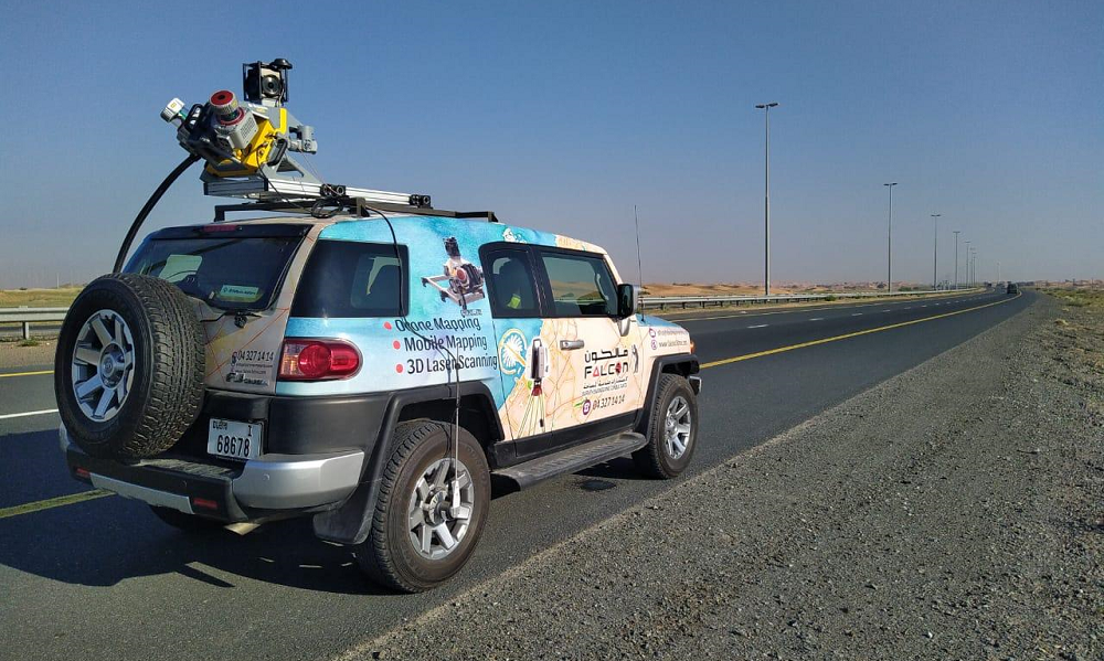
The Trimble MX9 is an innovative mobile mapping device that captures high-resolution geospatial data with exceptional precision. It combines several sensors, including LiDAR, cameras, and GNSS receivers, into a single, adaptable device mounted on a vehicle.
This enables efficient and reliable data collecting across wide regions without the need of traditional, time-consuming surveying methods.
- Data Collection: The First Step
The Setup
- The procedure begins with the Trimble MX9 being installed on a vehicle, usually a car or truck. The system is calibrated to ensure that all sensors are aligned and working properly. This arrangement is critical for accurate data collecting.
Capturing the Environment
- Once set up, the Trimble MX9-equipped car drives through the designated region of interest. As it moves, the system acquires a variety of data via its LiDAR sensor, which scans the area and generates rich 3D point clouds. Simultaneously, high-resolution cameras take photos from diverse angles, adding visual context to the data.
- Data Processing: Organizing and Integrating Raw Information
Data Integration
- The next step after data collecting is to process the information. The raw point clouds and pictures are loaded into Trimble’s software for integration. This entails merging LiDAR data with photos to generate a complete, georeferenced 3D representation of the studied region.
Quality Assurance
- Data quality is essential. The program contains quality assurance capabilities that enable users to verify and validate the data’s correctness. Any abnormalities or mistakes can be addressed at this step to assure the final dataset’s dependability.
- Data Analysis: Extracting Insight
3D Modeling and Visualization
- Users may create comprehensive 3D representations of the environment using processed data. These models are interactive, allowing users to zoom in and out, rotate, and see the region from various angles. This image aids in comprehending complicated spatial relationships and aspects.
Feature Extraction
- The Trimble MX9 software offers powerful algorithms for extracting certain aspects from data, such as building facades, roads, and utilities. These derived properties are useful for a variety of applications, including urban planning and infrastructure management.
- Decision-Making: Putting Insights into Action
Data Interpretation
- The insights acquired from 3D models and feature extraction are utilized to make sound judgments. For example, city planners may examine land usage, engineers can evaluate infrastructure issues, and environmentalists can keep track on natural resources.
Reporting & Sharing
- Trimble MX9 simplifies the generation of detailed reports and visuals that can be shared with stakeholders. These papers feature maps, models, and analysis findings to aid decision-making and project planning.
Integration of Other Systems
- The gathered and processed data may be incorporated into different Geographic Information Systems (GIS) and Building Information Modeling (BIM) platforms. This connection improves the capacity to handle and analyze data across several platforms, hence increasing overall project efficiency.
Conclusion
The Trimble MX9 mobile mapping system demonstrates how technology may help simplify the workflow from data collecting to decision-making. The MX9 converts complicated geographic information into useful insights using high-resolution, accurate data and powerful processing capabilities. Whether for urban planning, infrastructure management, or environmental monitoring, Trimble MX9 mobile mapping services provide a strong answer for today’s data demands.
As businesses embrace technology improvements, the Trimble MX9 stands out as a game changer in the mobile mapping space, opening the way for more efficient and informed decision-making.